Poor Farm maps (pdf)
Maps and Trail Plans
Parker County Nature Center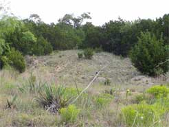
The Trails Team of the Poor Farm Advisory Group is currently scouting out good places at the Poor Farm to have hiking trails. Hiking is a great way to get out and enjoy nature, and a nature center just south of Weatherford would be very convenient for Parker County nature lovers to come out and hike.
With the creeks, abundant wildlife, and the view from the top of the mountain, I believe this place would be a great attraction in nature tourism. If we keep the habitat preserved as much as possible, the land will continue to give a sense of "untamed wilderness" to the hiker.
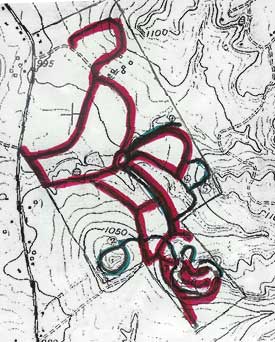 On the map to the left, put together by Leon Hitner, the highlighted red lines are the roads that Jim Webster has made, and the highlighted green lines are possible trails. As you can see on the map, there is a planned trail around Sam Savage Mountain, as well as a few around Kaliche Mountain. You can download a PDF file of this map at trailmap.pdf (193 KB).
If you are interested in helping us plan trails, you ought to join the Trails Team in the Advisory Group!
< Back to the Nature page